The Storegga Tsunami and Britain's Lost Land
A seabed area the size of Scotland slid away off Norway about 8,150 years ago. The tsunami left its mark from Greenland to Denmark and across the North Sea to Doggerland, and geologists still ask whether it could happen again.
A piece of seabed the size of Scotland suffered a submarine landslide off the coast of Norway about 8,150 years ago, triggering a series of giant waves. They travelled a long way. The tsunami left traces in western Scandinavia, the Faroe Isles, north-east Britain, Denmark and Greenland, and it crossed the North Sea to reach Doggerland, the drowned land that once joined Britain to Europe.
It predates any written record by thousands of years, but the proof is in the ground, in layers of sediment left behind by the tsunami, which scientists can test and date.
The trail it left
The University of Bradford puts the slide at around 3,200 cubic kilometres of material. The tsunami it set off is recorded in sediment deposits in the northern North Sea, along the north-east coasts of the British Isles and across the North Atlantic.
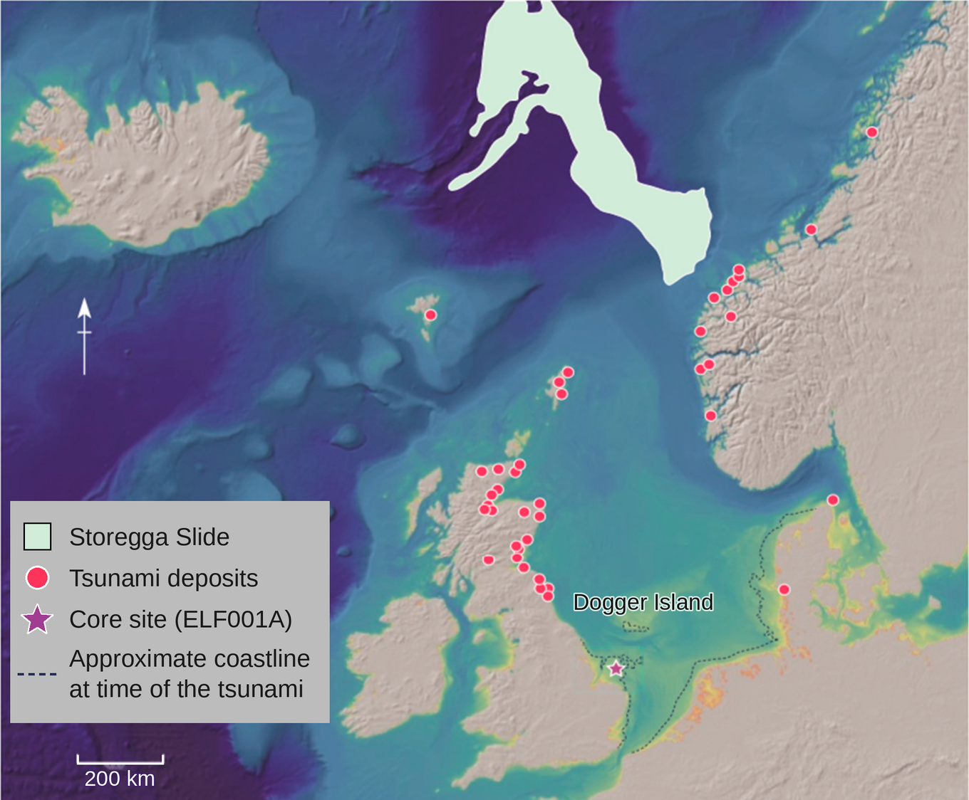
The southern North Sea was the awkward gap. Computer models had predicted that the wave would get there, but no direct physical evidence had been recovered, and the authors of a 2020 study called that lack surprising. If a tsunami crosses a sea, you expect it to leave some trace.
Reaching Doggerland
The evidence turned up in a core taken at the head of a drowned river system near the Outer Dowsing Deep, off eastern England. The team calls the channel the Southern River. Read from the bottom up, the core goes from quiet to violent and back again. Fine silt from a calm estuary ends at a sharp break, which the authors link to a sudden fall in sea level as the front of the wave approached, the water pulling away before it came in. Above the break sits nearly half a metre of sand, small stones up to three centimetres across, and freshly broken shells. Its chemistry swings between signals from the sea and signals from the land, which the team reads as water surging inland and draining out again. Then the silt settles back to normal.
Storms can leave similar deposits, so the researchers needed to verify everything. Seismic survey found the spot, and chemistry, microfossils, ancient DNA, luminescence dating and radiocarbon dating were used to test it. The results confirmed the earlier modelling. It was also a lucky find: the team took 15 cores and only one held strong evidence, because later erosion had erased most of the record from the others.
A forest in the way
The same paper says the effects here were temporary, localised, and softened by dense woodland and the lie of the land. It’s surprising to imagine woodland in a place now under the North Sea, but the ancient DNA backs it up. A team from the University of Warwick led by Professor Robin Allaby analysed 252 samples from 41 marine cores taken from the Southern River channel. Oak, elm and hazel showed up more than 16,000 years ago, thousands of years earlier than British pollen records had suggested. Lime trees appeared about 2,000 years before they do in the mainland record. There was even DNA from Pterocarya, a relative of the walnut that was thought to have vanished from north-western Europe 400,000 years ago. Allaby said the team “unexpectedly found trees thousands of years earlier than anyone expected”.
How much can a forest dampen the effects of a tsunami? The paper says the woodland and the lie of the land softened the effects, but not by how much.
Who was standing there?
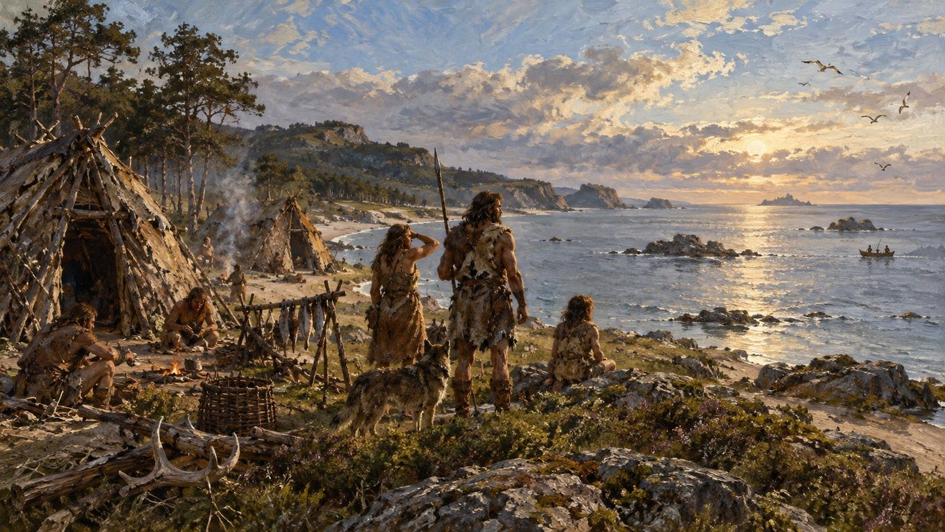
When the waves came, Mesolithic hunter-gatherers were living on what was left of Doggerland. Vince Gaffney of the University of Bradford says anyone caught in the runup zone would have faced devastating consequences, and it is easy to picture whole settlements swept away. The research does not go that far. The Bradford headline says the tsunami “devastated” ancient Britain, but the release itself is more measured further down. Modelling suggests that much of the landscape may have survived “reasonably intact” and returned quickly to pre-tsunami conditions, and the paper does not show how many people lived there or what became of them.
Did anyone watch the sea pull back and understand what it meant? Did the survivors return to the same shores once the land recovered? The Warwick team suggests that Doggerland’s woods could have supported early Mesolithic communities, and that this may help explain why so little early Mesolithic evidence survives on the British mainland. If so, much of that story is now under the sea.
Doggerland itself did not go under in a day. What remained of it was low-lying land running out from Norfolk to an archipelago centred on Dogger Bank, and the paper calls that landscape extremely vulnerable to catastrophic flooding. It was lost for good as sea levels rose to their present height, and the Warwick DNA work suggests parts of it were still above water around 7,000 years ago, more than a thousand years after the tsunami.
Could it happen again?
According to a research project by the University of Southampton there have been at least six mega-slides in the Norwegian Sea region in the last 20,000 years. Storegga, which it puts at about 8,200 years ago, was not the only one. The page also says the UK faces few, if any, other natural hazards that could do damage on the scale of a repeat Storegga tsunami.
Among the questions the project is asking is whether climate has any link to when the seabed shifts. Gaffney draws his own line across the millennia. In his words, the events leading up to the Storegga tsunami “have many similarities to those of today”, with a changing climate that weighs heavily on coastal regions.
Questions and answers
What is a submarine landslide?
A landslide that happens underwater. A mass of sediment or rock on the seabed gives way and slides down a slope. The very largest can displace enough water to set off a tsunami, as Storegga did. The University of Southampton calls the biggest ones mega-slides. Its researchers study them through sediment cores, and they say there have been at least six in the Norwegian Sea region in the last 20,000 years.
What and where was Doggerland?
Doggerland was land that now lies under the southern North Sea. Before rising seas cut Britain off, it was what joined Britain to mainland Europe. Ancient DNA shows it had woodland more than 16,000 years ago, and Mesolithic hunter-gatherers were living on what was left of it when the tsunami arrived. By then it was low-lying land running out from Norfolk to an archipelago centred on Dogger Bank. It was lost for good as sea levels rose to their present height, and parts were still above water as late as 7,000 years ago.
What and where were the Storegga slides?
They were a series of underwater landslides off the Norwegian coast, in the Norwegian Sea, about 8,150 to 8,200 years ago, depending on the source. Estimates put the moving mass at roughly 3,000 to 3,200 cubic kilometres, spread over 80,000 to 90,000 square kilometres of seabed, an area about the size of Scotland. The tsunami left deposits in western Scandinavia, the Faroe Isles, north-east Britain, Denmark, Greenland and the now lost Doggerland.
What caused the Storegga slides?
The final trigger is still a matter of interpretation, but researchers have explained why the seabed was ready to go. The slide began on a very gentle slope, averaging only 0.6 to 0.7 degrees. Rapid sedimentation during glacial periods had left water pressure trapped in the sediment, and the marine clay layers in the area lose strength as they deform. Modelling published in 2005 showed that these factors together make a huge slide possible even on a gentle slope, with the failure working its way upslope from where it began. Work cited by the authors points to a strong earthquake as the likely trigger. The Southampton project is looking at triggers more widely, including possible links between slides and climate.
Key dates
- More than 16,000 years ago
- Oak, elm and hazel are already growing in southern Doggerland, according to ancient DNA in seabed cores
- About 6200 BCE (roughly 8,150 years ago)
- The Storegga Slide moves a seabed area the size of Scotland off Norway and sends a series of giant waves across the sea
- About 7,000 years ago
- Parts of Doggerland are still above water, according to ancient DNA evidence, before the North Sea finishes forming
Sources
- 1Multi-Proxy Characterisation of the Storegga Tsunami and Its Impact on the Early Holocene Landscapes of the Southern North Sea (Gaffney et al., Geosciences 10(7), 270, 2020) (Peer-reviewed paper; open access.)
- 2Scientists find new evidence of massive tsunami that devastated ancient Britain in 6200BC (University of Bradford news release, 15 July 2020)
- 3North Sea 'Lost World' had habitable forests thousands of years earlier than thought (University of Warwick press release) (Reports the Allaby et al. ancient DNA study in PNAS.)
- 4The Storegga slide: evaluation of triggering sources and slide mechanics (Kvalstad et al., Marine and Petroleum Geology 22, 245-256, 2005) (Peer-reviewed paper. Its discussion of a likely earthquake trigger refers to earlier work cited by the authors.)
- 5Frequency and emplacement dynamics of submarine landslides (University of Southampton, Ocean and Earth Science, research project page)
Yorewire is independent and reader-supported. If this was useful, you can leave a voluntary donation: Support Yorewire. Donations do not buy influence over what we publish.